Cycles of Growth
It is often said that History repeats itself and, while that may be a bit of an exaggeration elsewhere, it isn’t here. Germantown has gone through three distinct phases of growth — in the 1840s, 1870s, and 1980s — that have all been very similar to one another.
The first boom period came when the Germantown Road was built in the early 1840s to connect Darnestown to Neelsville. Prior to that, there was no Germantown, just a collection of plantations isolated from one another and the rest of the world. The construction of the road led to the establishment of a town center, populated mostly by German immigrants who give this community its name. For the next half century, growth was concentrated around the intersection of Clopper and Germantown Roads.
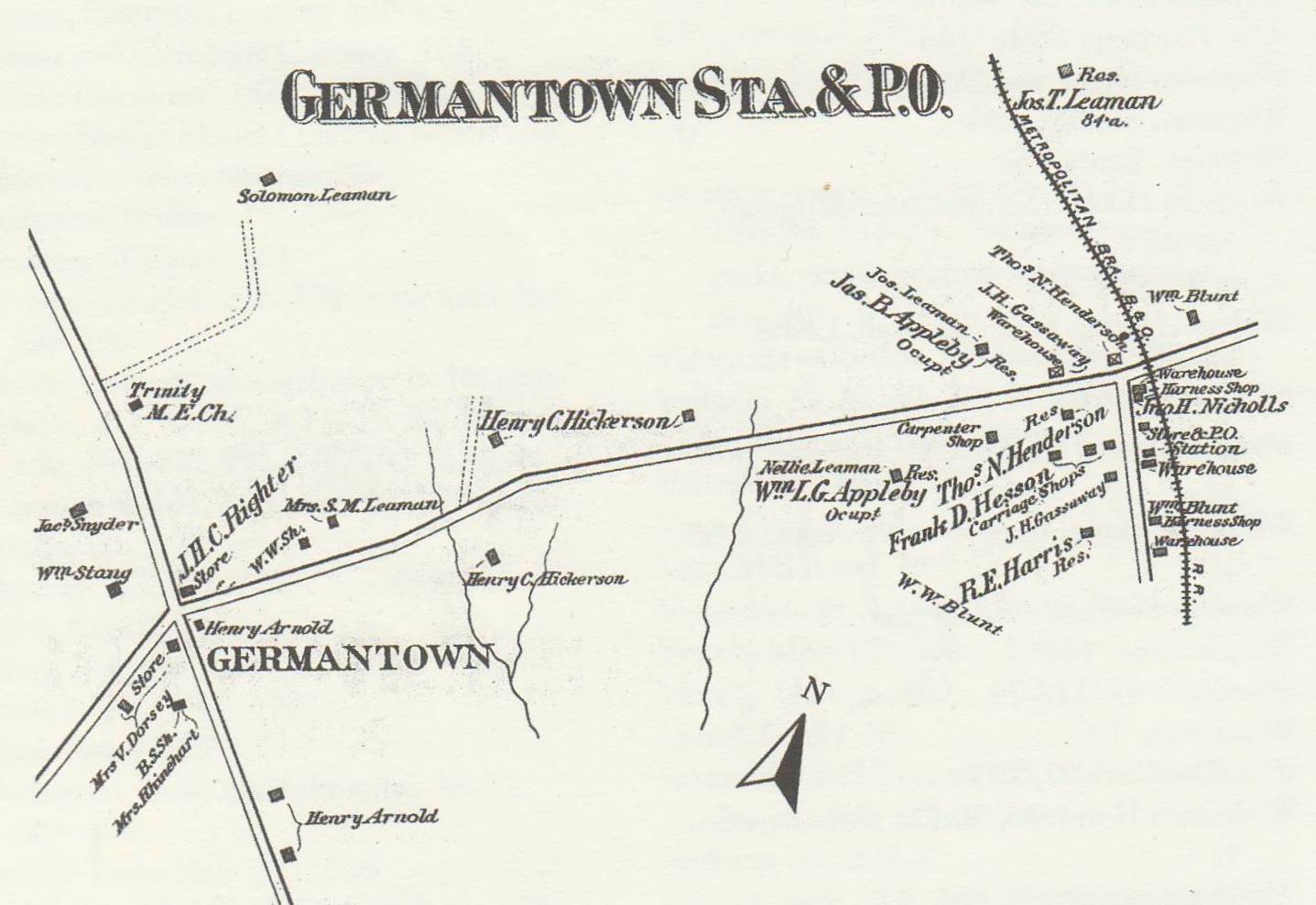
The second expansionary period emerged from the construction of the railroad in 1873. The Germantown train station was about a mile east of town center, but quickly became a hub for all local businesses. Virtually all new homes were built along Germantown road as close to the station as possible. During the next century, a massive steam-powered mill, the iconic Germantown bank, and virtually all of the surviving historic buildings were built within a mile of that spot — making it the new center of town.
When I-270 was completed in the the middle of the 20th century, residential growth started again in earnest. Like the previous two times, new employers moved in (in this case the Atomic Energy Commission is the most notable) followed by new residents. What differentiated this expansion period from the previous two was the introduction of planned growth, run by the Planning Board and M-NCPPC. Recognizing the potential for the region and the rapidly increasing need for various utilities and services, the Planning Board developed a Master Plan for Germantown in 1967 that laid out a vision for the next half century. The first major cluster of homes was completed between the late 1970s and early 1980s — populated by new residents and fueled by the new highway. Despite competing plans for town center close to the train station, where it had previously been, the new town center was ultimately located about a mile to the east so that folks could get off 270 and right into the heart of the community.
In each of these eras, a new transportation route that could carry more people more quickly brought new employment opportunities and new residents to the area. Almost poetically, the town center has moved a mile eastward twice just to be closer to those new transportation routes. History repeats itself in ways great and small. It would behoove us to pay attention to future regional developments in this light and think about how growth will look in the next century. The county is currently developing a General Plan for the next 30 years (the effort is called Thrive Montgomery 2050) that will involve new transportation and services for members of our community.